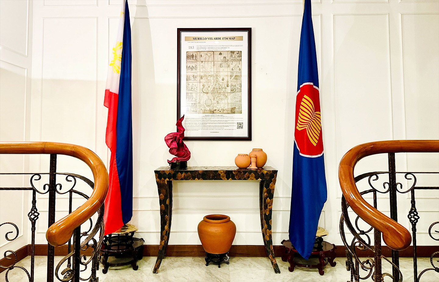
The 18th-century map, considered the oldest of the Philippines, highlights the country’s longstanding territorial claims and was unveiled at the Ambassador’s Official Residence in Singapore
Officials of the Philippine Department of Foreign Affairs’ Maritime and Ocean Affairs Office (MOAO), led by Deputy Assistant Secretary Emmanuel Donato K. Guzman, joined Ambassador Medardo Macaraig for the unveiling of the 1734 Murillo Velarde Map at the Official Residence in Singapore on 18 September 2025.
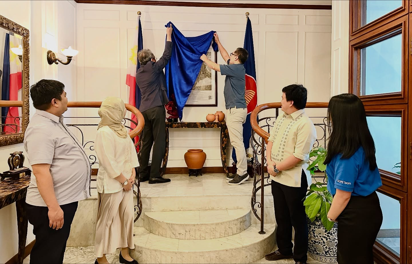
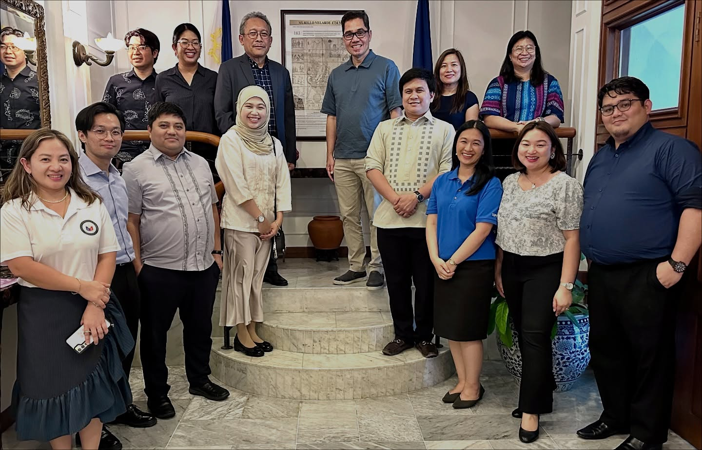
Image by Philippine Embassy in Singapore
The Murillo Velarde Map, also known as the Carta Hydrographica y Chorographica de las Yslas Filipinas Manila, is the oldest Philippine map. It clearly marks Panatag Shoal, also called Scarborough Shoal, as part of Philippine territory. The map was a key piece of evidence in the Philippines’ 2016 arbitration case concerning the West Philippine Sea.
Deputy Assistant Secretary Guzman was accompanied by MOAO Acting Director Edward D. Chan, Office of ASEAN Affairs Acting Director Josel N. Mostajo, and MOAO Principal Assistant Ashyanna Alexine Adia Amira-labi A. Bangcola. The DFA delegation was in Singapore for the 49th ASEAN-China Joint Working Group on the Implementation of the Declaration on the Conduct of Parties on the South China Sea (49th JWG-DOC), held from 17 to 19 September 2025.
The framed replica of the Murillo Velarde Map, often called the “Mother of all Philippine Maps,” had been presented to the Philippine Embassy by Secretary of National Defense Gilberto C. Teodoro Jr. through the Philippine Defence and Armed Forces Attaché on 27 September 2024. It was initially displayed at the Embassy’s temporary office at TripleOne Somerset before its installation at the Ambassador’s Official Residence. The unveiling formed part of the Embassy’s commemoration of the 2025 Maritime Archipelagic Nation Awareness Month.
Source: Philippine Embassy in Singapore


